
Digital technology is having a profound influence on the way we work and deliver projects, particularly in the international development sector.
It has allowed our technical specialists to design innovative solutions and solve complex problems on behalf of our clients. This is helping our international development projects to reach greater numbers of poor and marginalised people more quickly and effectively through information services, websites, transactional services, web applications, mobile apps and mobile cash transfer programs. In particular, monitoring and evaluation services are becoming increasingly important in contributing to the successful delivery of development projects.
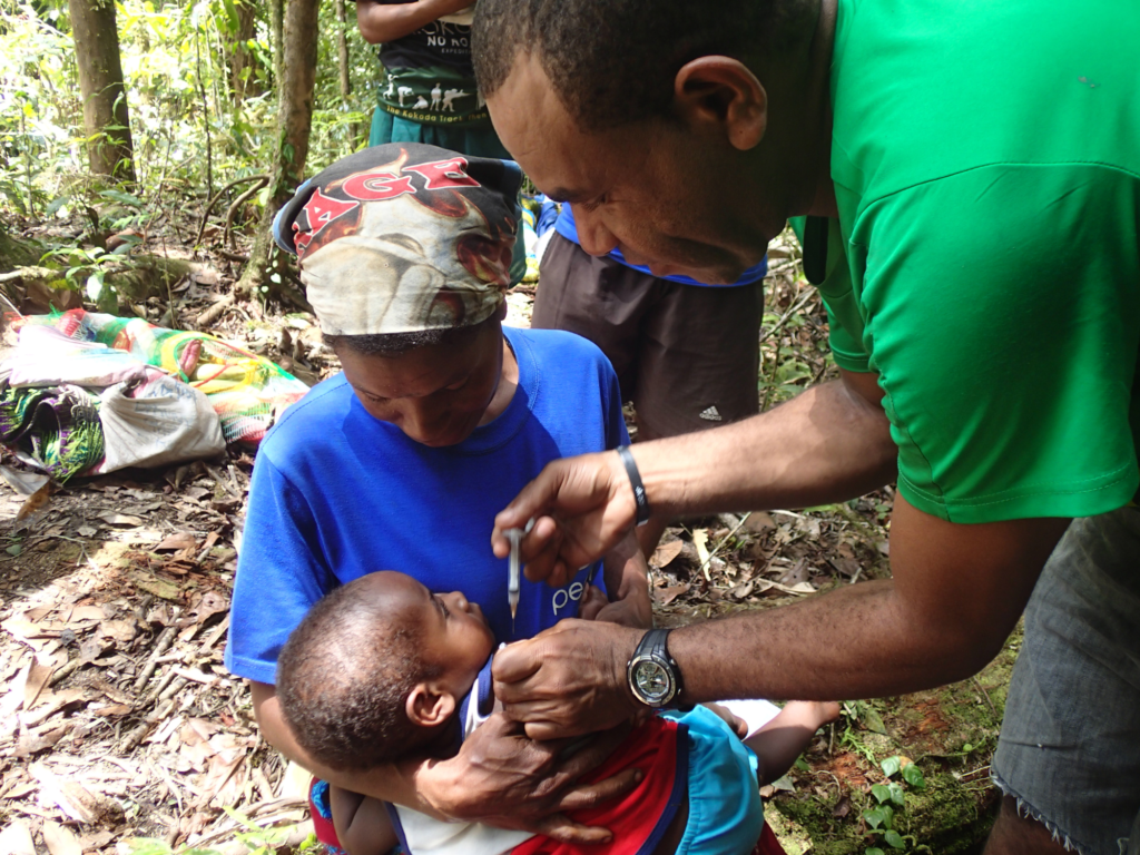
The need to monitor and measure the impact of development programs over time is a critical step in reaching the 2015 United Nations Sustainable Development goals, which aim to reduce poverty, improve education, adapt to and mitigate climate change, improve access to health and gender equality, among others. However, the remote nature of many affected areas makes accurately recording and evaluating data challenging. Many remote areas do not have internet access, and traditional paper-based methods increase risks to security, information storage, and limit the range of people who can access and update the information.
Tetra Tech’s innovative, custom-built solution
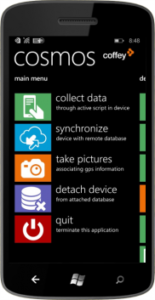
Tetra Tech wanted to improve our capability in this area by providing our research, monitoring and evaluation (RME) teams with the latest digital tools that would help them to collect and analyse data more efficiently and cost effectively. Cosmos, the Tetra Tech Spatial Mobile Solution, was developed by Tetra Tech’s International Development – Europe IT team. Cosmos is a purpose-built mobile data collection tool and reporting system, designed and built using the revolutionary capabilities of today’s mobile technology. It leverages the power, flexibility and scalability of cloud technology to enable our researchers to easily conduct surveys, data analysis and reporting for projects in challenging environments.
Because Cosmos was designed by our in-house survey specialists it can be fine-tuned based on field experience and lessons learnt from previous projects. The platform has a sophisticated survey engine which can be easily customised to support complex surveys. It is also designed to provide multilingual support and offers a case follow-up capability which is a useful way to measure the impact of our projects.
Benefits of Cosmos
- Cosmos is custom built by us and well-aligned to our project needs.
- Cosmos is re-usable which is much more cost-effective than purchasing a new system for every project.
- Cosmos works in remote locations where there is poor communications infrastructure.
- Cosmos minimises the amount of inconsistent data collected.
- Cosmos provides automated interactive dashboards and reporting in real time.
- Cosmos maintains full control and security over all data collected on behalf of our clients.
- Cosmos significantly improves the speed and efficiency at which data is collected.
- Cosmos enables us to respond much more quickly to our clients.
- Cosmos ensures flexibility with how we manage our data and where it is stored.
How Cosmos is benefitting our projects and our clients
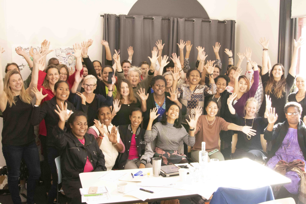
Cosmos has been deployed on projects across Europe, Africa and Asia on behalf of three of our largest clients, the European Commission, UK Department for International Development (DFID) and Australia’s Department of Foreign Affairs and Trade (DFAT).
Our Growth and Employment in States – Wholesale and Retail Sector (GEMS4) project in Nigeria is using Cosmos to conduct a rice cluster mapping exercise. Information from the exercise is aimed at supporting investment, development and policies throughout the sector. It is estimated that by December 2017, the cluster mapping report would have helped to attract £2 million worth of investment, 100 jobs and linkage of 2,000 rice farmers to rice processors.
“The consultants were full of praises for the Cosmos app. They said it was most user-friendly mobile survey mobile software they have seen yet.” Toni Akinluyi, GEMS4
The Zimbabwe Livelihoods, Food and Security Programme (LFSP) is using Cosmos to deliver the programme’s monitoring, reporting and evaluation framework. Cosmos has been used to survey 2641 respondents and collected data on 1815 different variables which created almost two million rows of data for the baseline study. This has enabled the project team to provide early consultations with donors, the Government of Zimbabwe, and other actors working in the agriculture and food security sector.
“A big benefit of the Cosmos system is data security. Data collected about development is often sensitive – whether it concerns peoples’ identities, behaviours, activities or locations – so it is crucial it does not fall into the wrong hands, not least because it’s often data about some of the globe’s most vulnerable people.” Mike Brewin, LFSP
The Basic Education Quality and Access in Laos (BEQUAL) programme is using Cosmos to capture high quality photographs of school areas needing repair. Over 25,000 photographs from 406 different schools, spread over an area from the Chinese border in the north to the Cambodian and Vietnamese borders in the south, have been collected and stored in our secure cloud repository. This has enabled the project’s key stakeholders to have early access to the field survey data for analysis. The photos have also provided assurance to our clients that the approved works at the targeted schools are being completed.
“The system has strong quality assurance benefits including assuring our clients that the approved works at the targeted schools have been completed.” Andrew Whillas, BEQUAL
We are delighted with the way Cosmos is adding value to our projects. It is helping our research teams to become more efficient with data collection, analysis and reporting. The platform continues to evolve as we regularly add new features to enhance and improve the way we collect and manage data on behalf of our clients. Demand has grown significantly over the past year and continues to grow with many more projects planning to use Cosmos in the pipeline.
How Cosmos works
A mobile phone is used to collect data via a customised survey designed specifically for the project. Every single piece of data is automatically tagged with geographical identification metadata including GPS (Global Positioning System) co-ordinates, date/time, speed, course, altitude and accuracy using the mobile device’s built-in GPS hardware. The data collection is captured offline and uploaded to the cloud when an internet connection is available. Photographs can be captured throughout the survey and are also geo-tagged.
The data is visible on a map or reporting dashboard in real time. For the map view, you can zoom in and out to view more detailed information. The photographs that have been taken can be viewed and saved.
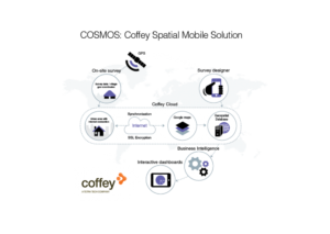
All collected data—including photographs—can then be accessed through a user-friendly web portal, which uses Google’s mapping technology to visualise data in real time as it’s synchronised from the field. Security of our client’s data is of the utmost importance so we designed Cosmos to use advanced encryption standards to ensure all data is stored and synchronised securely which makes it virtually impossible to tamper with any data.
Cosmos provides a cost effective, practical and secure method of collecting, storing and analysing data in some of the world’s most remote regions.
More comments
“We need to know where the poorest and most vulnerable people are, how much food we are growing, the impact of biodiversity loss, the pace and speed of climate change, and much more besides. And to understand these issues we need data, consistent, high-quality, disaggregated data for every country in the world.” Jessica Espey, UN Sustainable Development Network
“Monitoring and evaluation… are no longer added as an afterthought, but are at the core of most development programs.” Mike Brewin, Zimbabwe Livelihoods and Food Security Program
“As well as permitting early access to the field survey data for analysis, the system will reassure our clients that the approved works at the targeted schools have been completed.” Andrew Whillas, Basic Education Quality and Access in Lao PDR
“When we assess the impact of an activity, such as the rebuilding of a school, we can use Cosmos to rapidly assess the impact on educational outcomes for the local students, for example, has the new building resulted in additional enrolments and attendance?” Anne Stasinowsky, Tetra Tech Senior Project Manager, Basic Education Quality and Access in Lao PDR